
SAN ANGELO, Texas — The "Pray for Rain" signs across West Texas are never removed, but when Texans prayers are answered we often times forget, we could always use more rain. 2018 was a record-setting year for the region in many ways. Yet, the thirst for additional rain for our ranchers and farmers is a worry we all shouldn't forget about.
I wanted to take a few minutes and share of we are doing on rainfall so far for the year, compare that to the start of 2018, and share my forecast moving through the rest of the seven days.
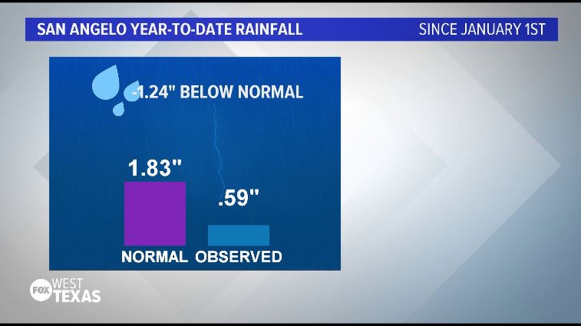
Remember official weather data that is logged into the archives comes from Abilene Regional Airport and Mathis Field. Therefore, keep in mind there are places that have seen a lot more than this and there area also other areas that have seen much less.
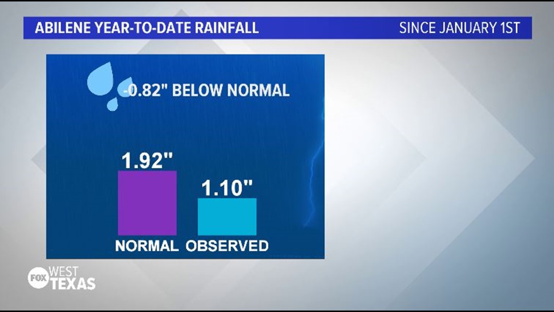
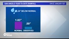
So far, 1.10-inches of rain has fallen at Abilene Regional. By Feb. 20 averages, we should have seen at least 1.92 inches. That's 0.82 inches below normal for the year. At Mathis Field, 0.59 inches of rain filled the rain gauge. That's nearly an-inch and a quarter below where we should be (1.83 inches).
This is in ways similar to the start of 2018.
ABILENE
January 2018 - Trace
February 2018 - 1.3"*
*NOTE: Data is adjusted to not include Feb. 21-28, 2018
SAN ANGELO
January 2018 - 0.01"
February 2018 - 0.19"
*NOTE: Data is adjusted to not include Feb. 21-28, 2018
JANUARY-FEBRUARY 2019 in Abilene is off to a very close start to the same time frame in 2018. While in San Angelo, we are off to a better start. I'm not insinuating there is a definitive, direct correlation between the first part of the current and previous year.
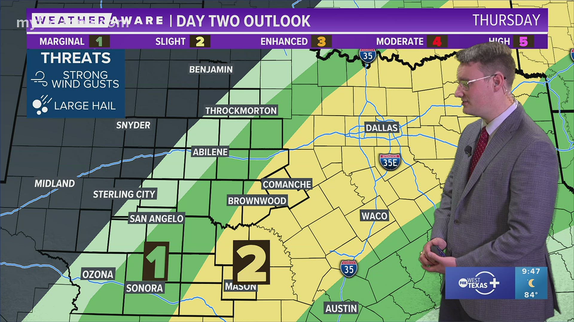
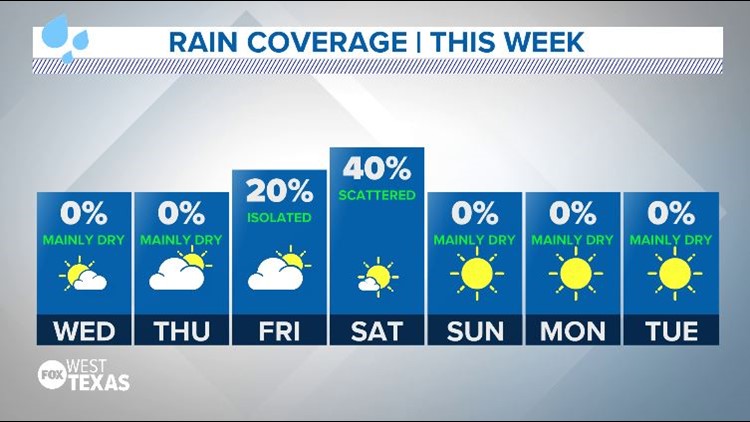
The good news moving forward is that the forecast does include additional chances for rain thanks largely to a weak, yet present, sub-tropical jet. See my discussion on the weak El Nino feature by clicking here. We also have a few waves of energy that will move or traverse through the region providing enough lift and instability to initiate showers or thundershowers. Severe weather is not expected at this time.
If you have any questions please feel free to connect with me on social media!
Enjoy the day!
Chief Meteorologist Ricky Cody