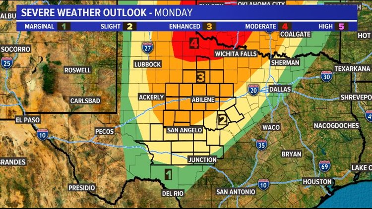
SAN ANGELO, Texas — I know we are still more than 48-hours out, but confidence is growing in our next round of severe weather. So much so, that a enhanced risk of severe storms includes much of West Texas.
Model guidance agrees that moisture, lift and instability will all be present ahead of our next system Monday.
While the threat for significant tornadoes is more likely across the Texas Panhandle and central Oklahoma, large hail, damaging winds and tornadoes are possible by the afternoon on Monday.
Two major features will interact with our forecast during this time including a warm front that will likely stall along the Red River and a dryline to our west.
We will continue to monitor the developments and provide updates as they become available.