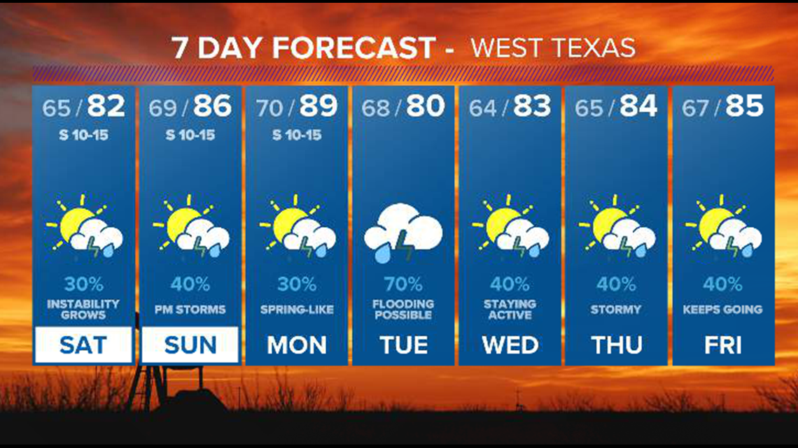

SAN ANGELO, Texas — Dew point values will continue to rise this weekend as southeasterly winds continue to bring plentiful moisture to West Texas from the Gulf of Mexico. This will lead to day-to-day shower and storm chances that will continue for the region through next week.
The potential for severe weather also exists over the next week.
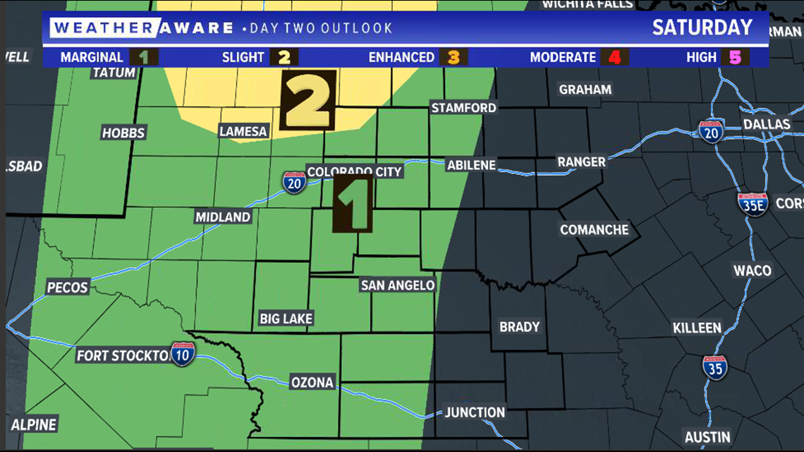
Saturday is the first chance for strong to potentially severe storms. Although some activity is possible during the day, the greatest risk for severe weather will be in the evening hours as strong storms form along a dryline in the Permian Basin. A marginal risk (level one of five) for severe storms has been issued for the western half of our area, with a slight risk (level two of five) far northwest towards Lamesa and Lubbock. Storms will slowly weaken as they push eastward late Saturday.
Saturday severe weather outlook:

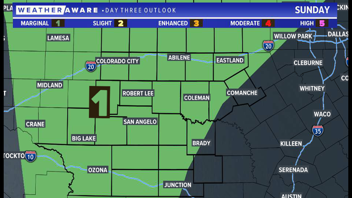
Another risk of strong to severe storms comes Sunday evening as more isolated storms are expected to form across West Texas. A marginal risk (level one of five) has been issued for much of the area.
Sunday severe weather outlook:

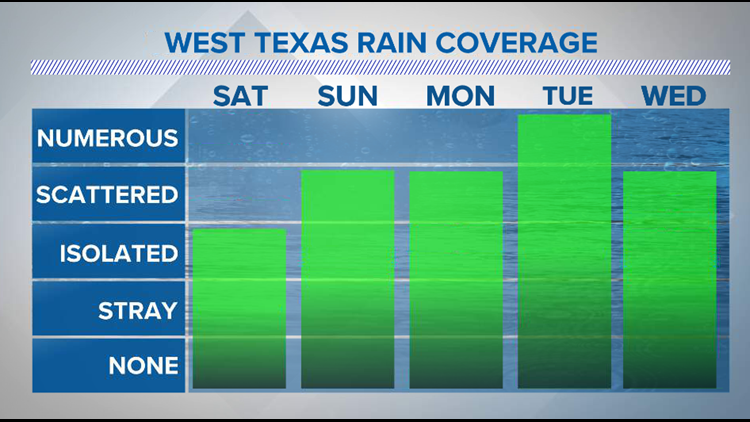
The threat of storms continues all throughout next week as moisture stays high. Projected rain totals through next Friday (May 21) show widespread one to three inch totals across West Texas, with locally higher amounts possible.

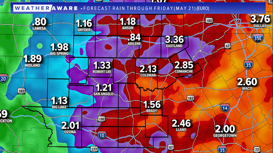
It will not rain and storm consistently, but each day has the threat of seeing activity develop. The greatest amount of rain and severe weather threat is likely on Tuesday. However, forecasts may change. Please be sure to stay with FOX West Texas for the very latest.
West Texas seven-day forecast: