


TEXAS, USA — There is a severe thunderstorm watch in effect for portions of the Big Country until 10 p.m. Tuesday night.
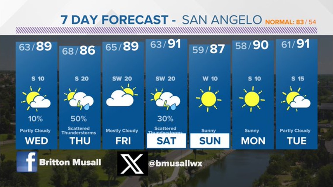
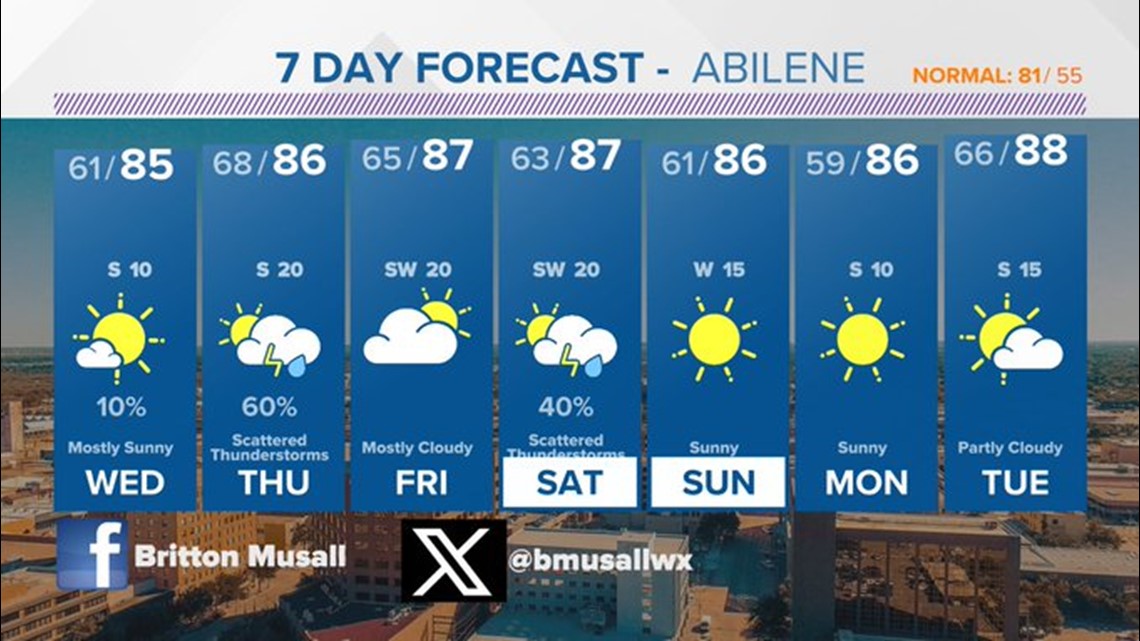
Any thunderstorms that develop along the dry line Tuesday evening could have large hail and damaging winds. Most of our area will stay dry, but storms that form will likely be quite strong. Be sure to stay weather aware. Wednesday, we'll have a threat for strong-to-severe thunderstorms similar to Tuesday's risk.
A couple thunderstorms Wednesday afternoon and evening could have some quarter sized hail and gusty winds. The highest chances for severe storms will be in western portions of our viewing area.
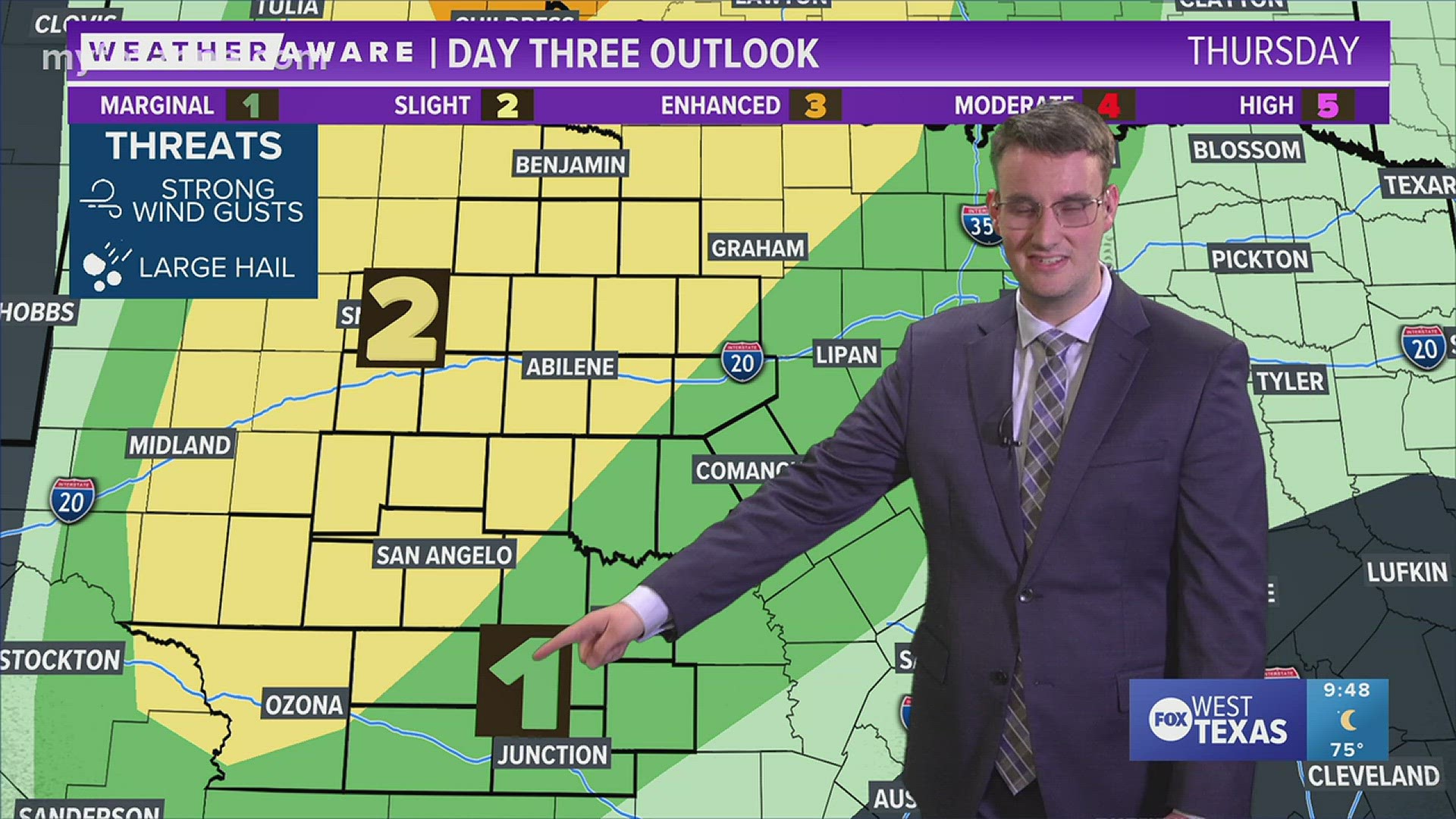
Thursday there is a slight risk (2/5) for strong-to-severe thunderstorms afternoon into the overnight. It looks like large hail and damaging winds will be the main threat with this. Since this will likely impact us in the overnight hours be sure to have a way to receive warning while you are asleep.
Friday, most of the activity should be to our east, and then there will be another local threat for strong-to-severe thunderstorms Saturday. I'm not expecting any one of these days to be a total washout, but you'll want to stay weather aware with several opportunities for strong-to-severe thunderstorms.
For those of us who do not see strong-to-severe thunderstorms you can expect mostly sunny conditions and very warm temperatures.
For your latest weather update you can always find them online and on social media.
Stay connected with the FOX West Texas Weather Team 24/7
Meteorologist Britton Musall:
Resources