
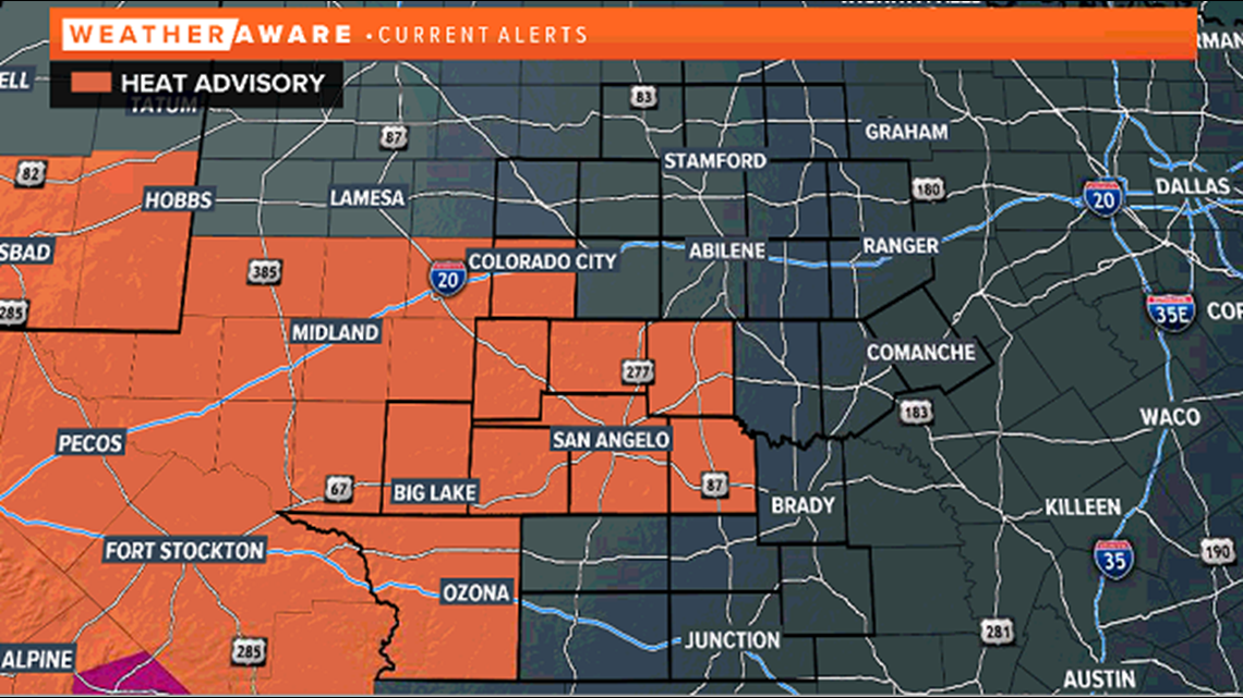
SAN ANGELO, Texas — A heat advisory is in effect for parts of West Texas Monday afternoon. It is set to begin at 2 p.m. and expire at 7 p.m. Much of the Concho Valley is included in this, including San Angelo.

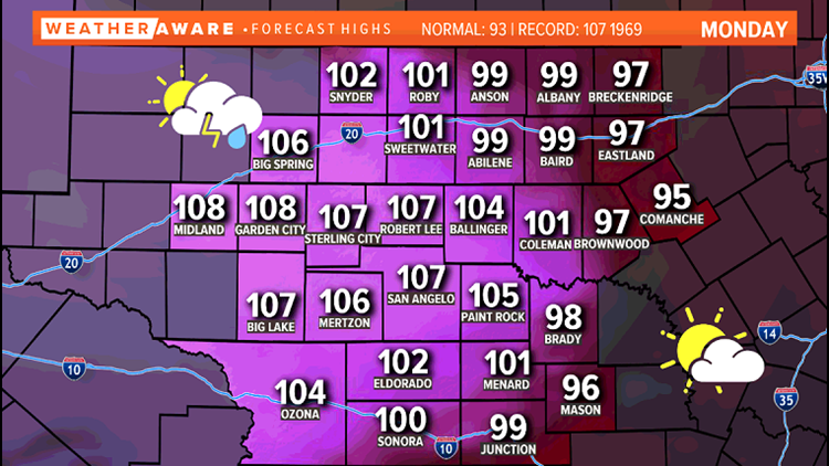
Temperatures are expected to reach up to 108 degrees in parts of the area. Combined with humid air still in place, heat index values could exceed 110. Make sure to take it easy outside and drink plenty of water.
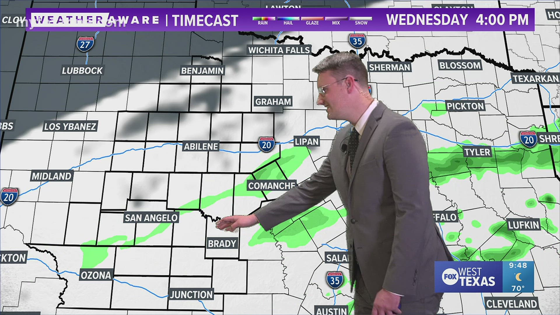
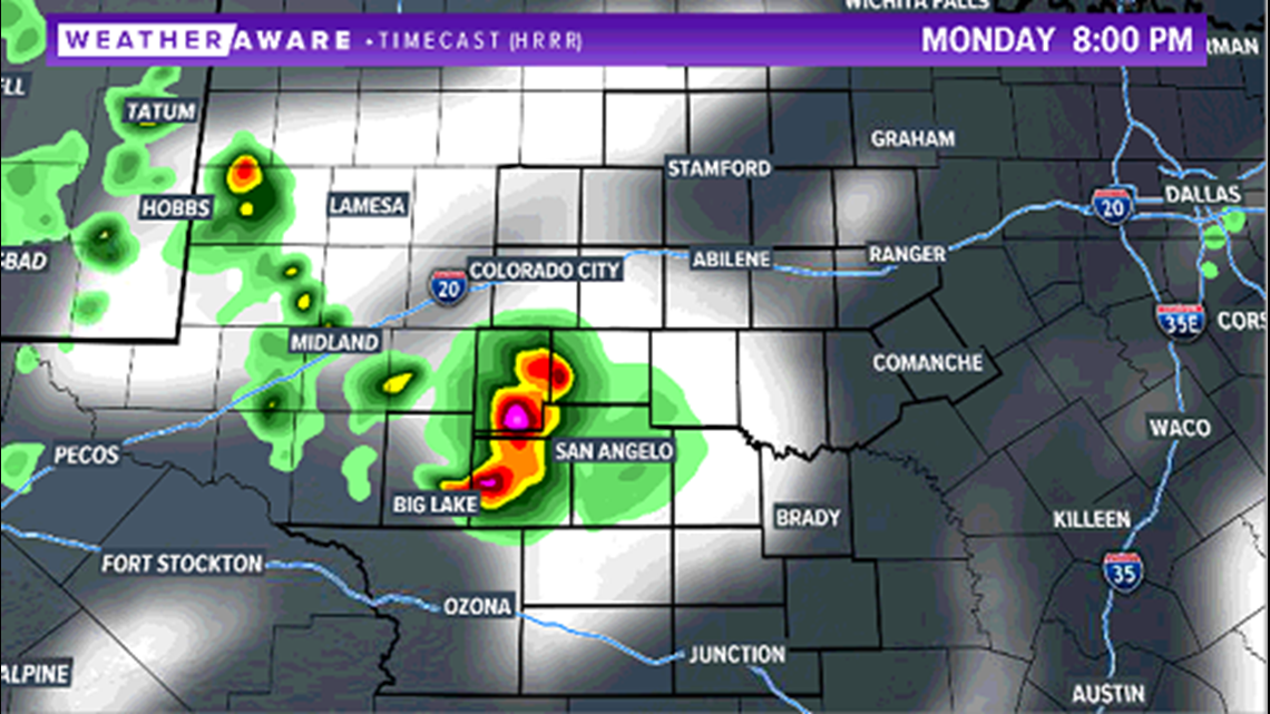
After the temperatures climb to near oppressive levels, attention turns to the skies where strong to severe storms may develop. A few isolated showers and storms are expected to develop in the northern Concho Valley this evening and move very little. Heavy rainfall, lightning, gusty winds and hail will be the main threats.

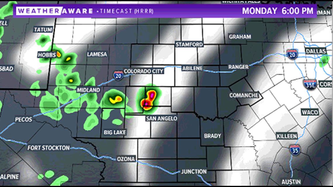
With very little movement expected from these storms, much of the area will just remain hot and breezy throughout the evening with only about 20% of the area picking up on any storm activity.

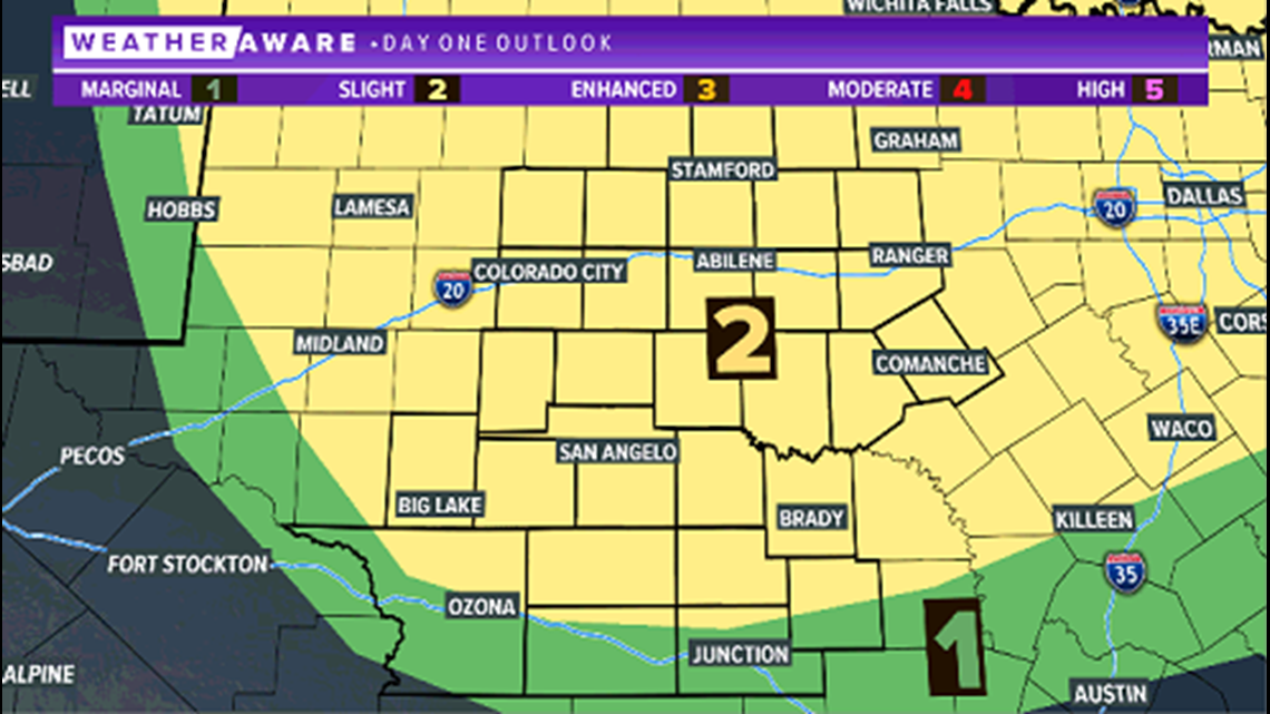
A slight risk of severe weather (level two of five) has been issued for much of West Texas.

Additional showers and storms are expected to develop late Monday evening in the Big Country and continue through the overnight hours. The best chance to pick up on a good soaking rain during the overnight time frame will be along and north of Interstate 20.

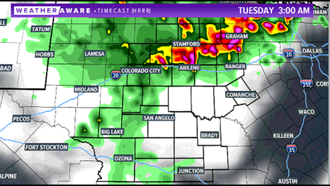
Some lingering showers may extend into Tuesday morning before skies turn partly cloudy during the daytime. Additional showers and storms are possible Tuesday evening with rain chances continuing during the day Wednesday as well.
Make sure to stay with FOX West Texas and our FOX West Texas Facebook page for the latest information.