
SAN ANGELO, Texas — After several days of above-average temperatures, Friday will remind us all that it is late October as the first of two strong cold fronts over the next week moves into West Texas.
Mainly clear skies are expected overnight Thursday into Friday with temperatures only dropping once again into the middle 60s throughout the area.
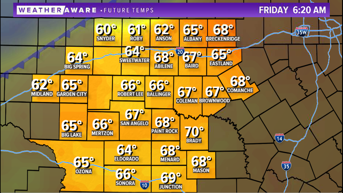
6:20 a.m. temperatures:

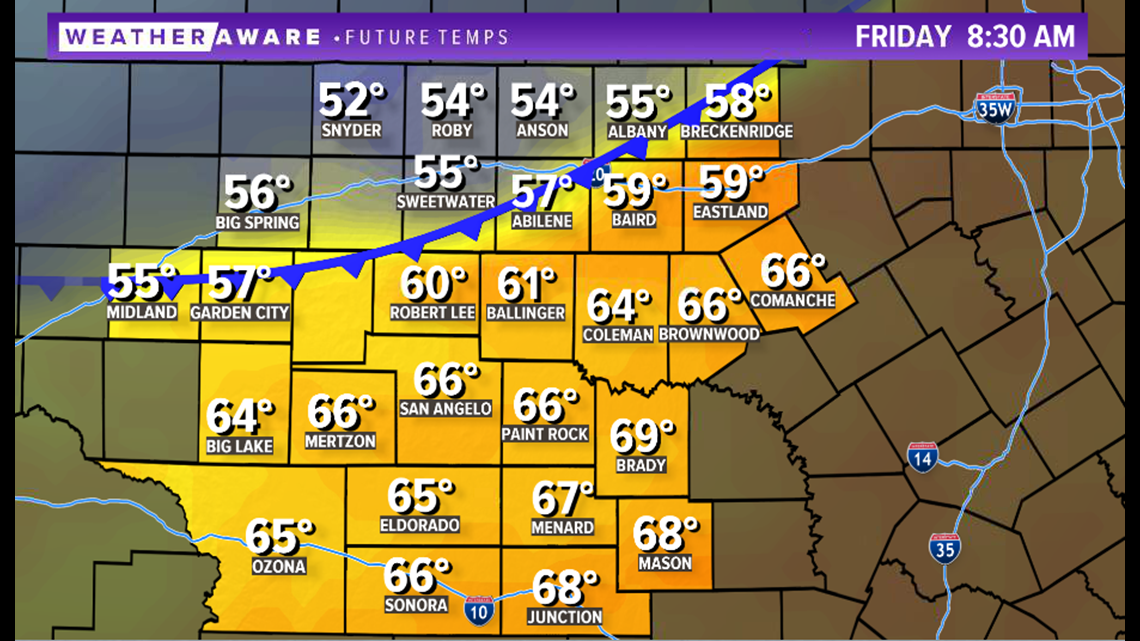
Later in the morning however, the front will begin to move southward across West Texas. Behind the front, mainly cloudy skies, patchy drizzle, strong northerly winds and much cooler temperatures are likely. By 9 a.m., the front is expected to have moved through the Big Country and will drop south of I-20.
8:30 a.m. temperatures:

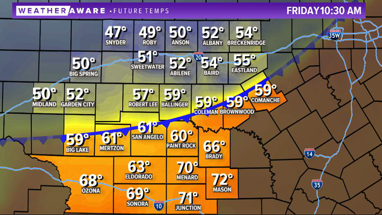
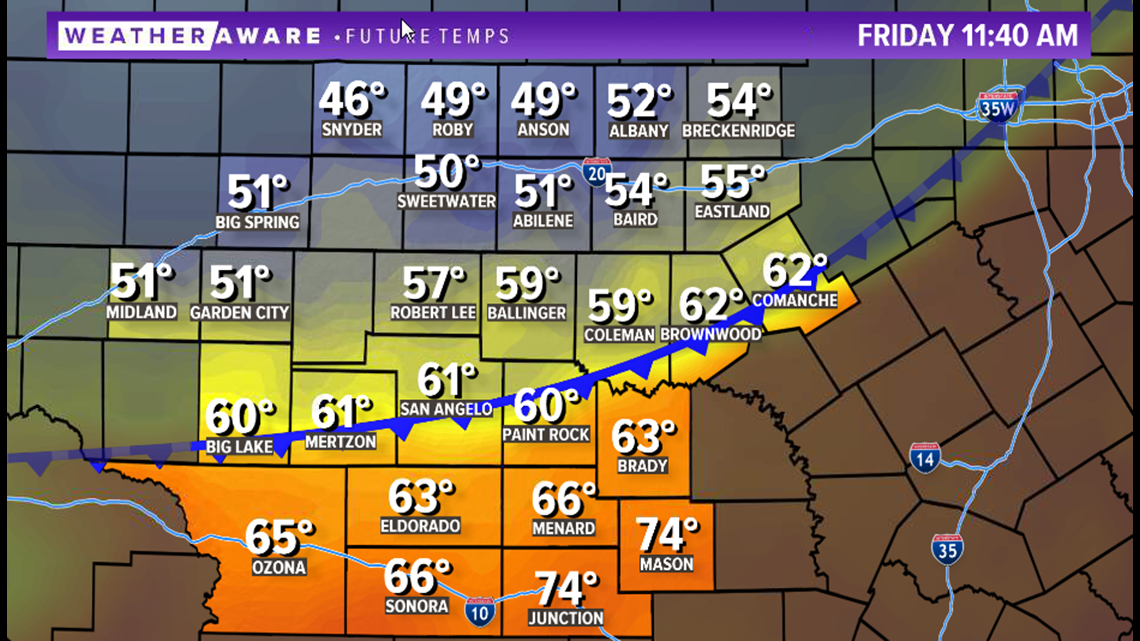
By the late morning, the front will have pushed into the Concho Valley with daily highs already being reached. Big Country temperatures will fall into the 40s.
11:40 a.m. temperatures:

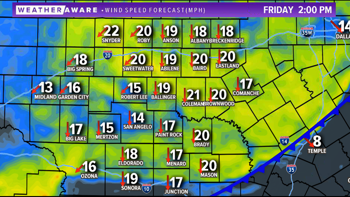
Strong northerly winds behind the front will blow upwards of 20-25 mph. Gusts in excess of 30 mph are likely.
2 p.m. winds:

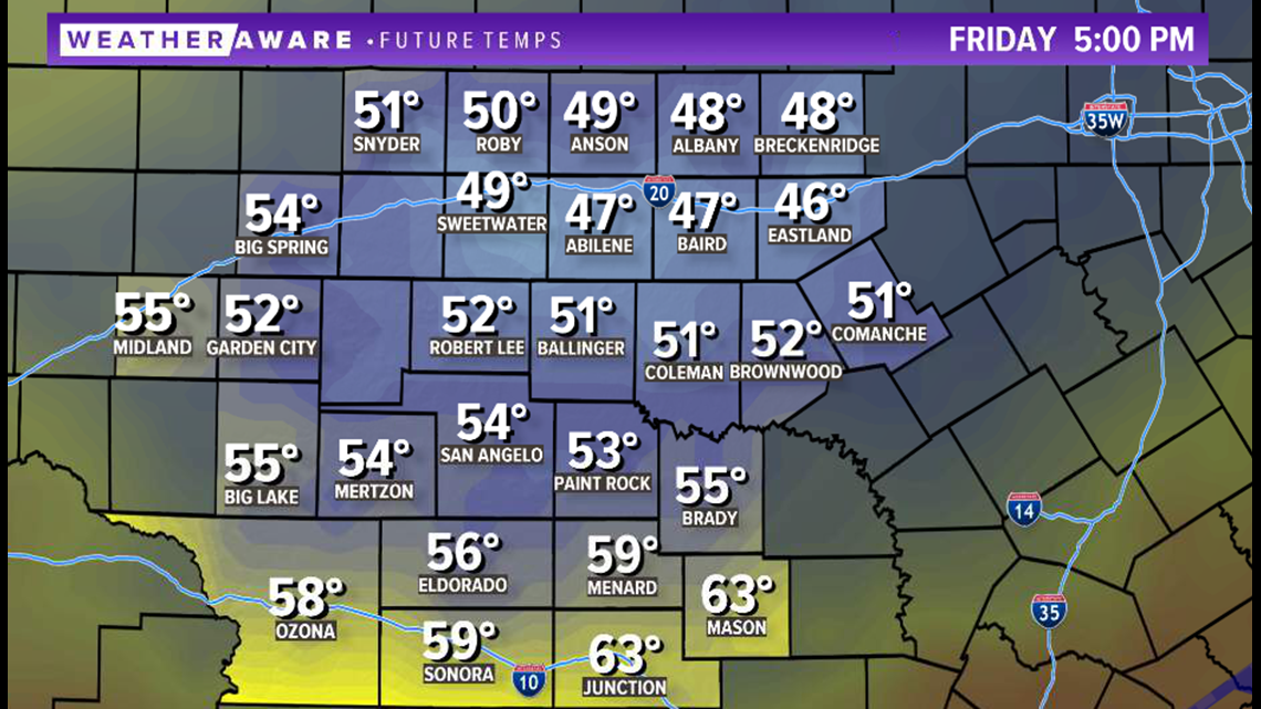
Friday afternoon, cloudy skies will be present throughout the region, with temperatures in most locations hovering in the upper 40s to lower 50s.
5 p.m. temperatures:

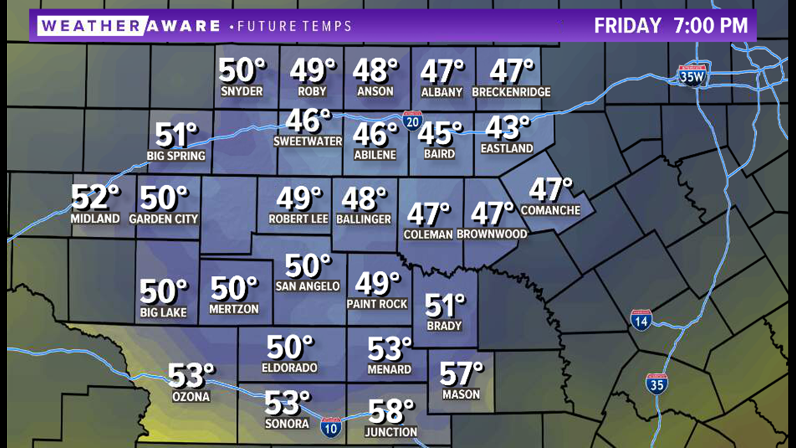
If you plan to go to any Friday night football games throughout West Texas, definitely grab that jacket as game time temperatures will be near 50 degrees with breezy north winds.
7 p.m. temperatures:

After a brief warm up Saturday and Sunday, an even stronger front will push into the area Monday, bringing winter temperatures into next week.
Stay with FOX West Texas for the latest information.