
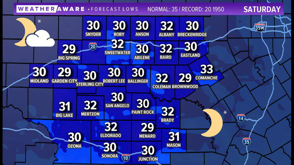
SAN ANGELO, Texas — Another chilly night is on the way for West Texas Friday into Saturday. Overnight lows will drop into the 30s, with a few locations dropping under the freezing-mark once again.

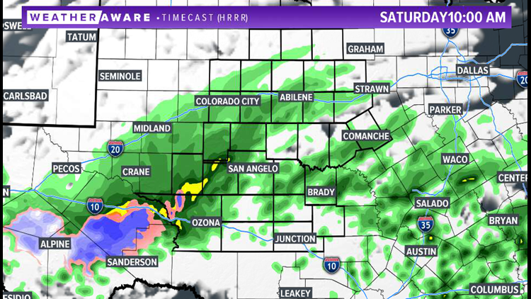
Clouds will be on the increase overnight, with a few showers possible by early Saturday morning. A few flurries may mix in.

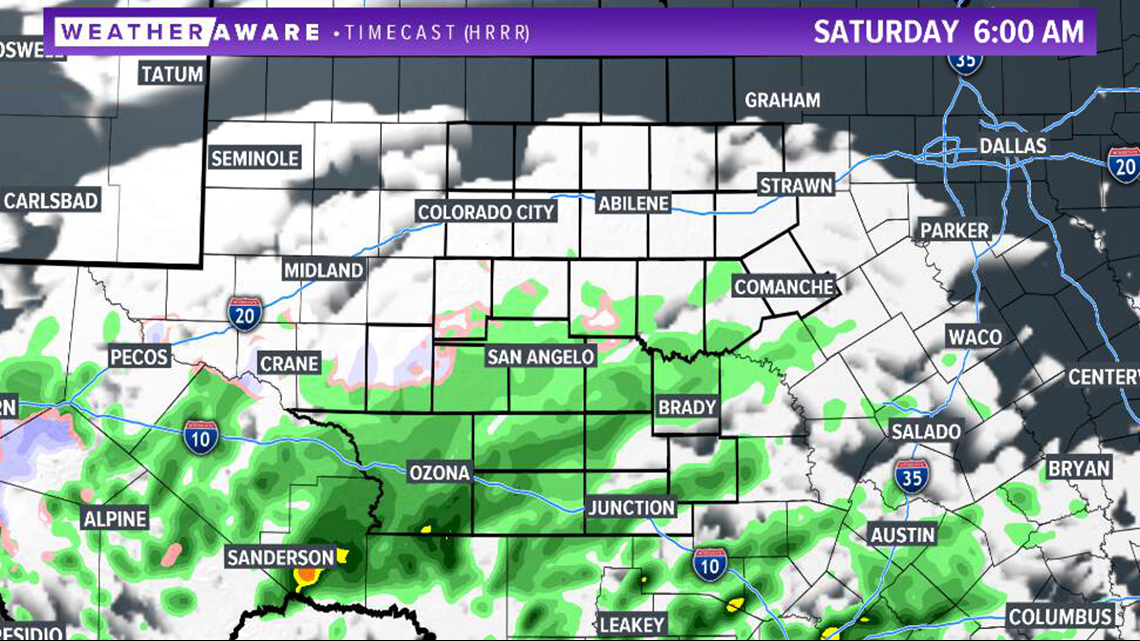
By the late-morning hours, precipitation will increase in coverage. About 40% of the area will see scattered activity. This precipitation will be light in nature. Most of the area will stay dry and chilly throughout the day. Highs will be in the upper 40s in the Concho Valley and lower 50s in the Big Country. Snow is likely to our southwest, mainly in the higher elevations near the Big Bend

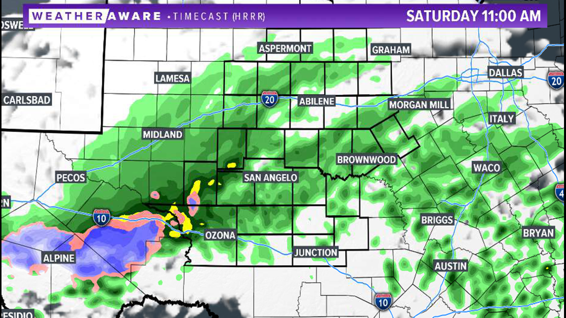
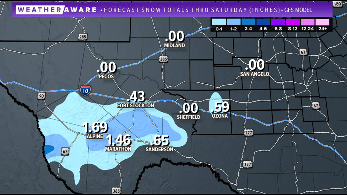
One-to-three inches of snow is possible in higher elevations of the Big Bend. Be on the lookout for potential road impacts west of Ozona on I-10. Most of the accumulation will be south of the interstate, in the upper elevations.

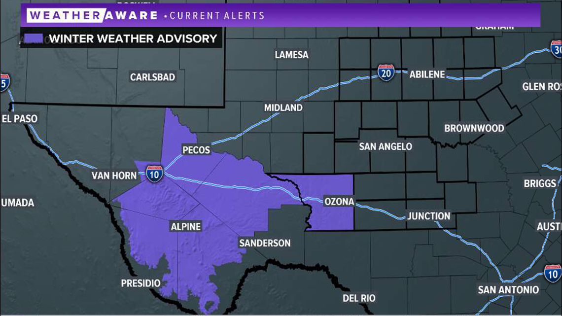
Because of the threat of winter precipitation, a winter weather advisory is issued for much of the Big Bend region from 6 a.m. Saturday until 3 p.m. Saturday. This includes Crockett County.

Sun will return to the forecast Sunday with highs back in the 60s throughout West Texas. Stay with FOX West Texas for the latest information.