

SAN ANGELO, Texas — Has it felt humid, at times unbearable, and all you wanted was for a little rain? Well, that wish just might come true with the weather setup across the Concho Valley on Thursday.
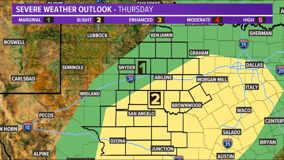
The Storm Prediction Center (SPC) in Norman, Oka., has a good section of West Texas under a SLIGHT risk for severe weather beginning Thursday morning through the evening. A MARGINAL risk includes points north. The major concerns during this time will be very large hail, gusty winds and an isolated tornado cannot be ruled out.
The big takeaway here is that atmosphere is very unstable. Any storm that develops will do so quickly. On that same note, any storm that develops will likely be strong and potentially severe with the same aforementioned risks.
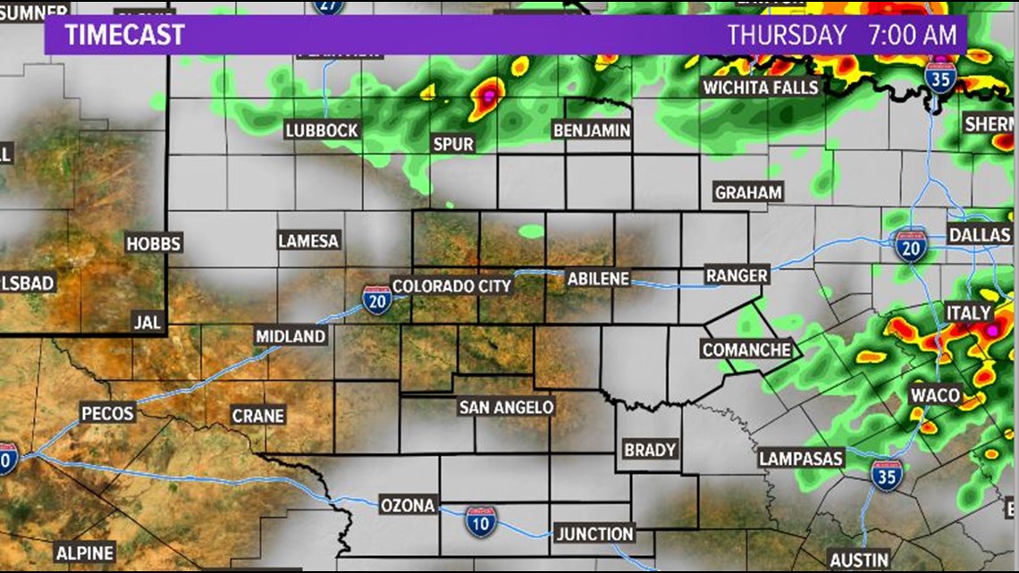
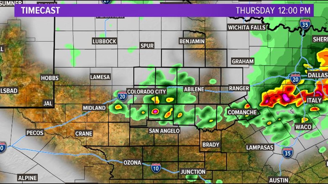
This does NOT mean the forecast included widespread strong or severe storms. It DOES mean that conditions will be very favorable for development. Here's one forecast model projection of the storms. Please note the timestamps in each photo in the upper-right hand portion of the image.
Expect a partly cloudy sky to start the day with a few sprinkles or light showers in the mix. The better coverage for rain will arrive later Thursday afternoon.
By the afternoon, as long as the moderate cap, or the warm stable layer of air above us begins to erode, any storm that develops could turn strong rather quickly. A strong updraft will allow for very large hail to form and lightning will be very frequent.
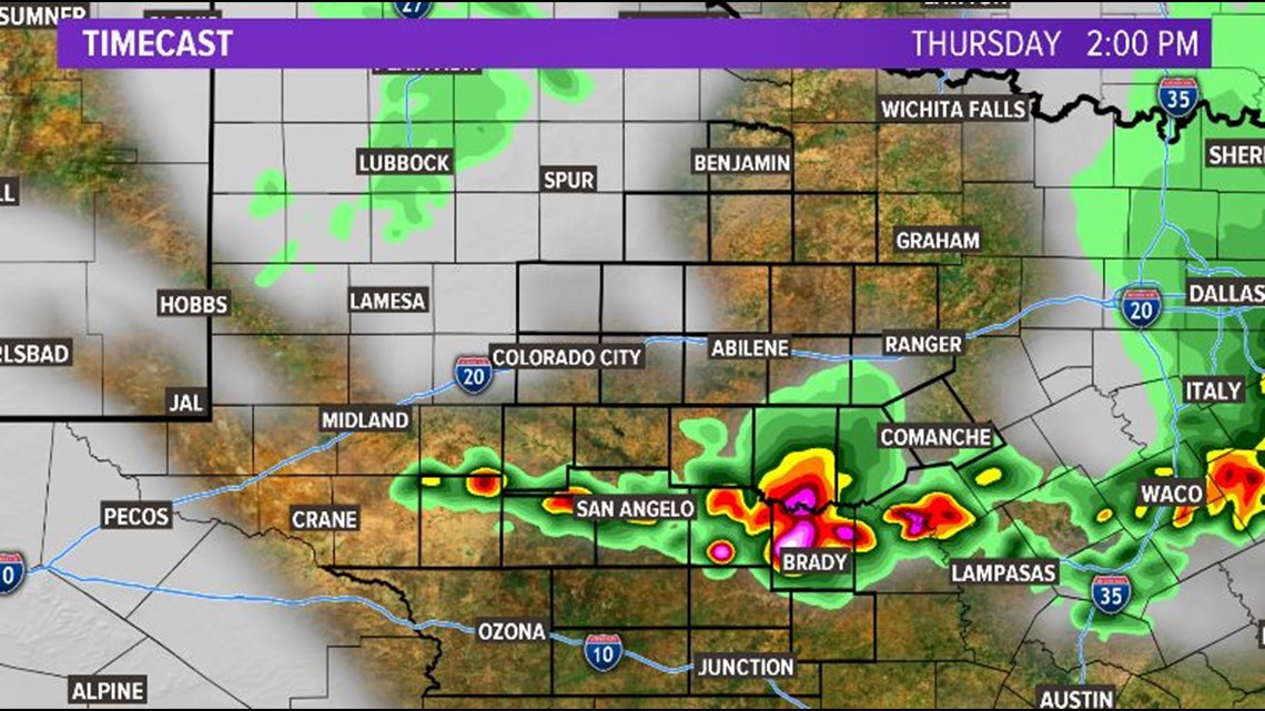
By 2 PM, the forecast will be very dependent on the storms that developed before these. If the atmosphere remains unstable with this outflow boundary, more widespread storms will be likely.
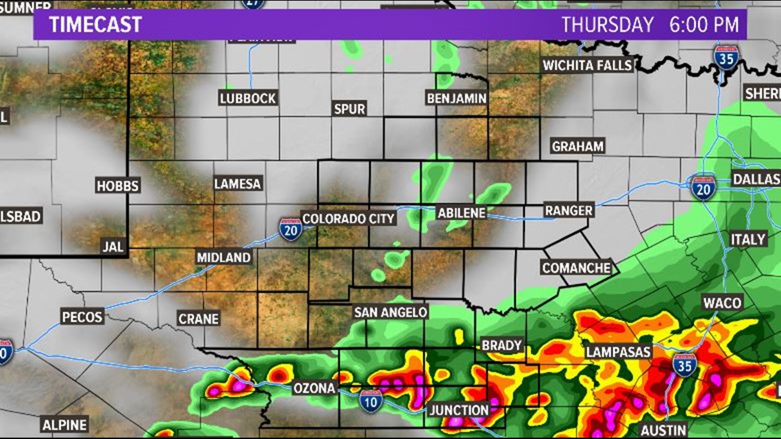
By the late-afternoon, showers and storms will shift more south with the better coverage of strong to severe storms to be along I-10 in the southern Concho Valley.
This is a developing weather situation and we will continue to provide updates throughout the day. Be sure you have two or three ways to receive weather alerts.
Stay safe and weather aware!
-Chief Meteorologist Ricky Cody