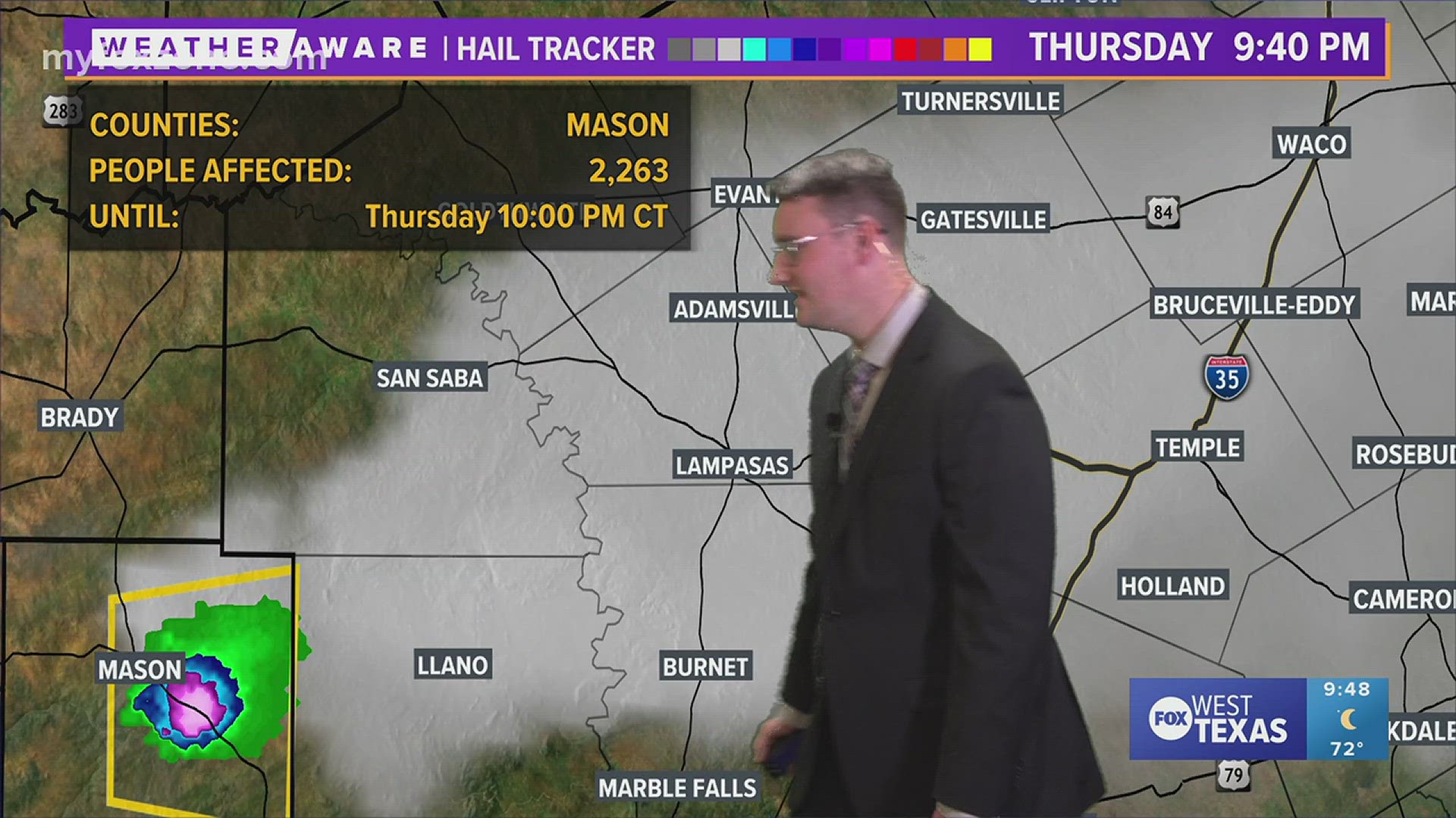

SAN ANGELO, Texas — Strong to severe thunderstorms are expected to develop in the Permian Basin Thursday afternoon. These storms will move eastward throughout the evening hours, bringing strong winds, large hail and a threat of isolated tornadoes.
6 p.m. Thursday projected radar:

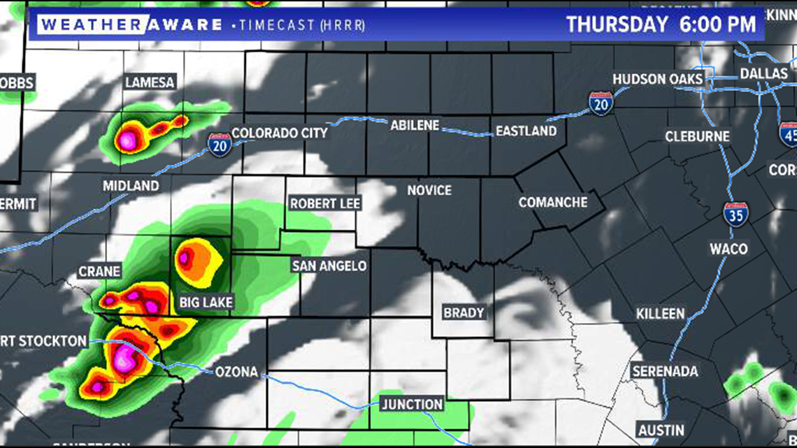
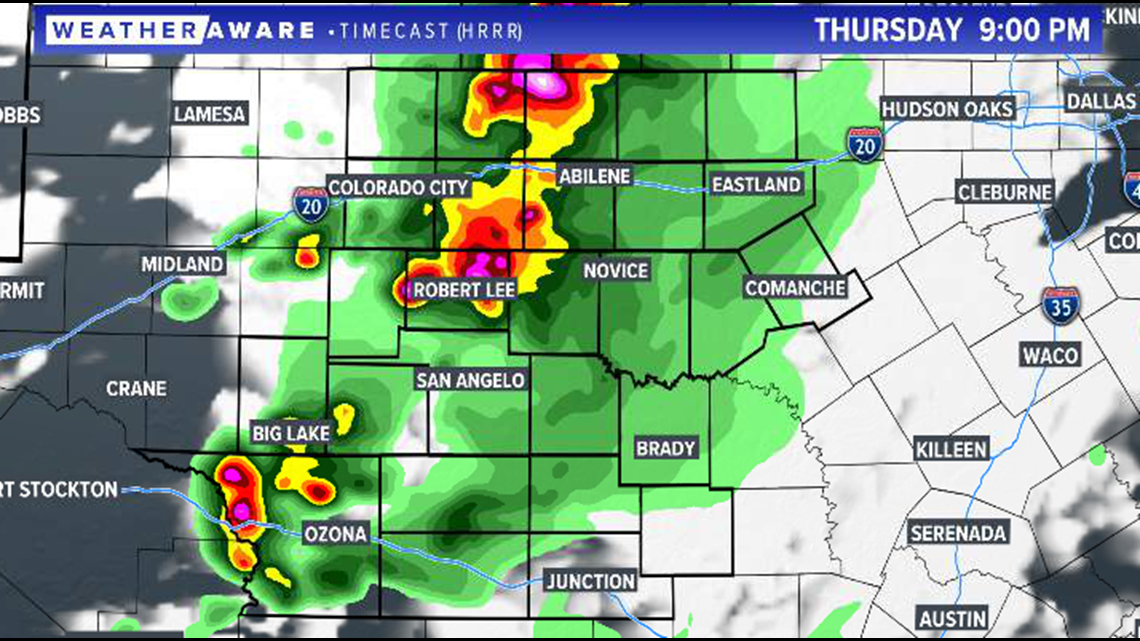
The best chance of strong storms in the area will be across the Big Country, however a few storms may also threaten parts of the Concho Valley.
9 p.m. Thursday projected radar:

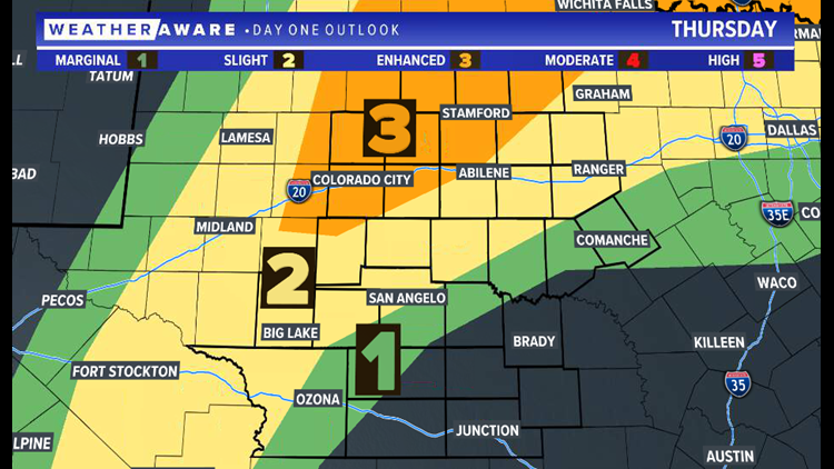
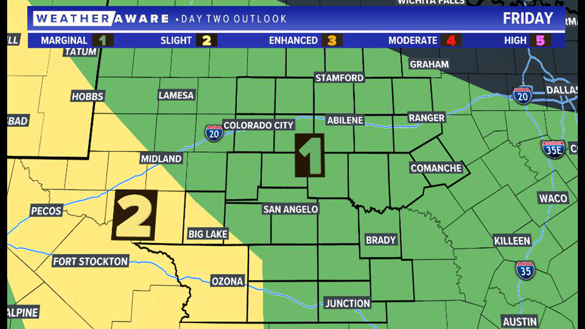
Additional strong to severe storms are in the forecast Friday. A marginal risk of severe weather (level one of five) and a slight risk of severe weather (level two of five) has already been issued for the region.

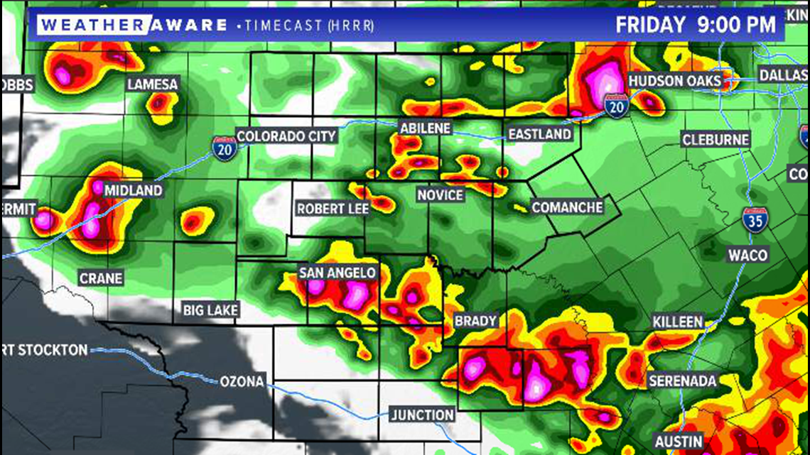
Once again, the evening hours will be the most active and storms will have the potential for strong winds, large hail and even isolated tornadoes.
9 p.m. Friday projected radar:

Stay with FOX West Texas for the very latest information.