
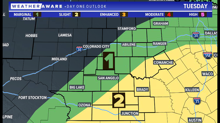
SAN ANGELO, Texas — A slight risk of severe weather (level two of five) continues for our southern communities across West Texas Tuesday evening as a stationary front stalls near Interstate 10.
This stationary front will initiate additional showers and storms throughout the afternoon and evening. The strongest cells will have the potential for isolated hail and damaging winds.
The greatest threat area will be near this stationary front along the I-10 corridor. Isolated light to moderate showers are possible further north in a cooler airmass.
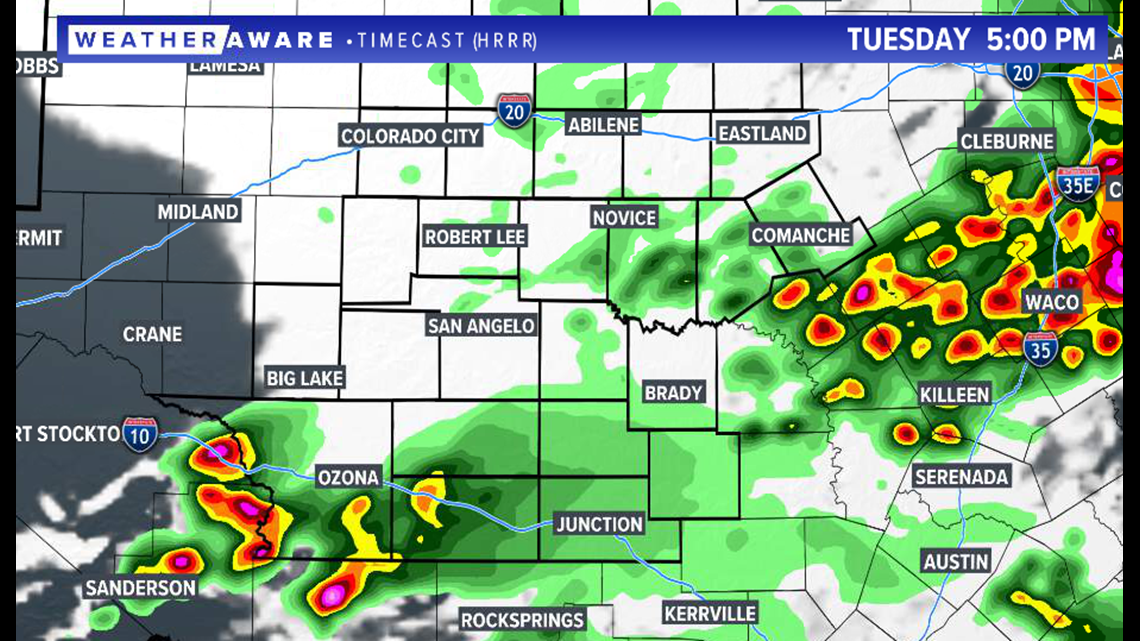
5 p.m. Tuesday projected radar:

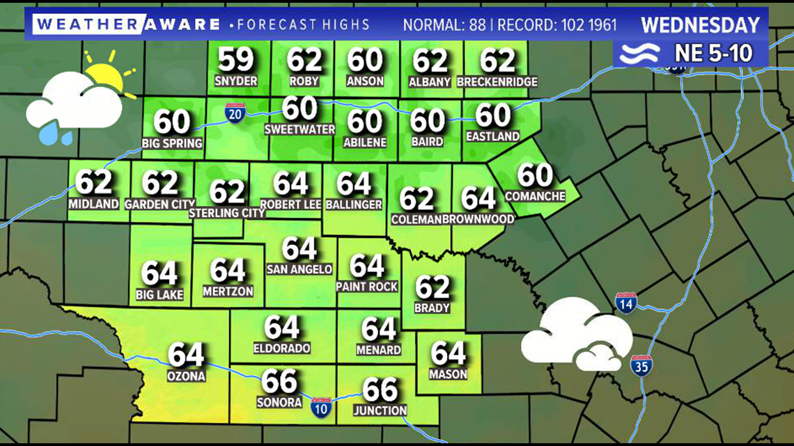
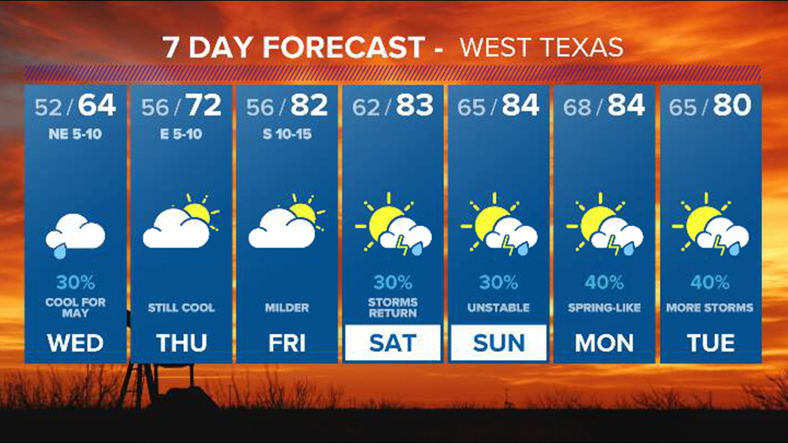
Overcast skies and the possibility of light showers continue Wednesday with temperatures remaining well below seasonal averages. Temperatures will struggle to reach the middle 60s with a northeasterly breeze continuing. Average highs for mid-May in West Texas are in the middle 80s.
Wednesday projected high temperatures:

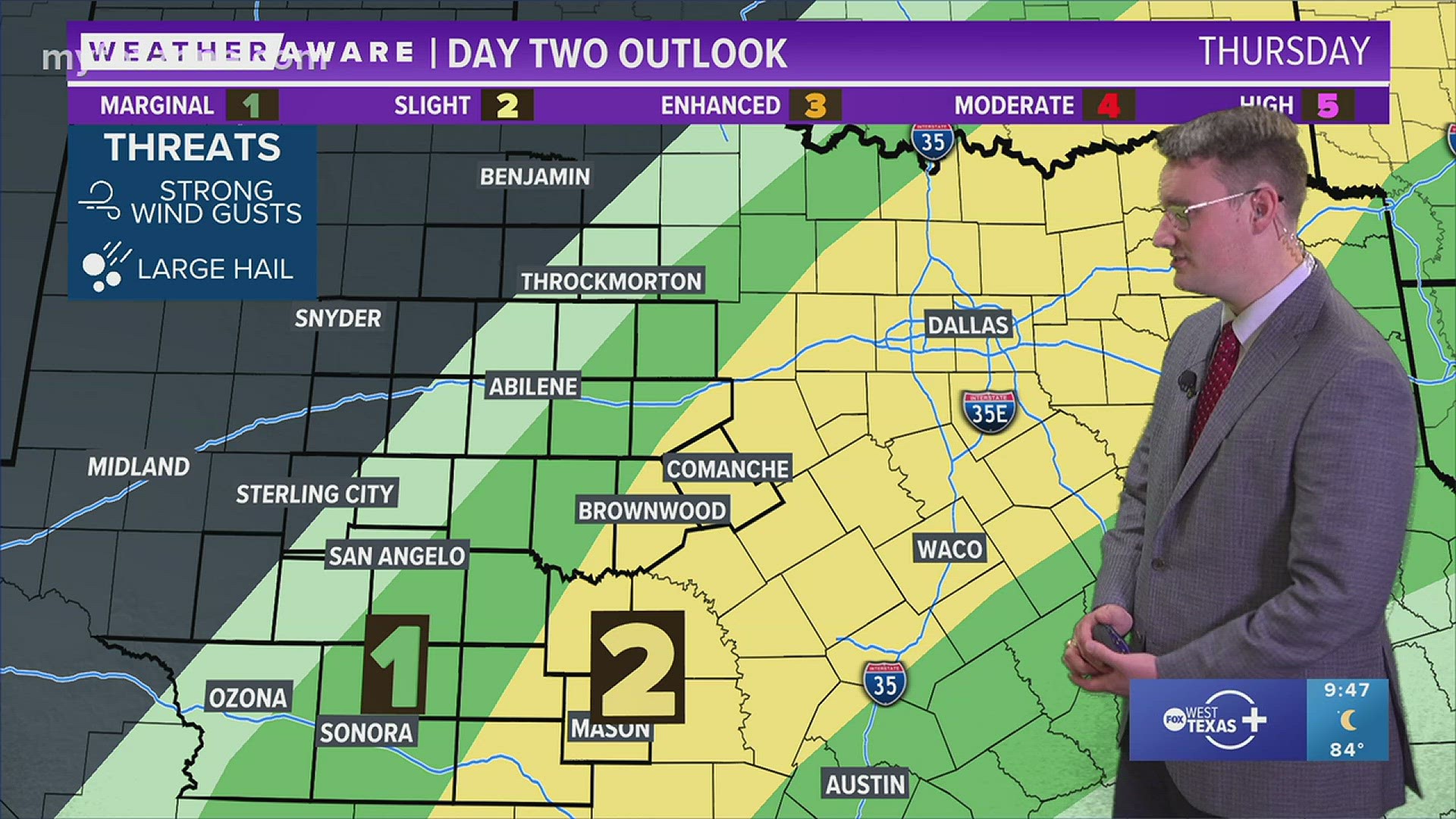
Drier and slightly warmer conditions are expected Thursday and Friday. Storm chances return to West Texas this upcoming weekend.
West Texas 7-day forecast:

Stay with FOX West Texas for the latest information.